
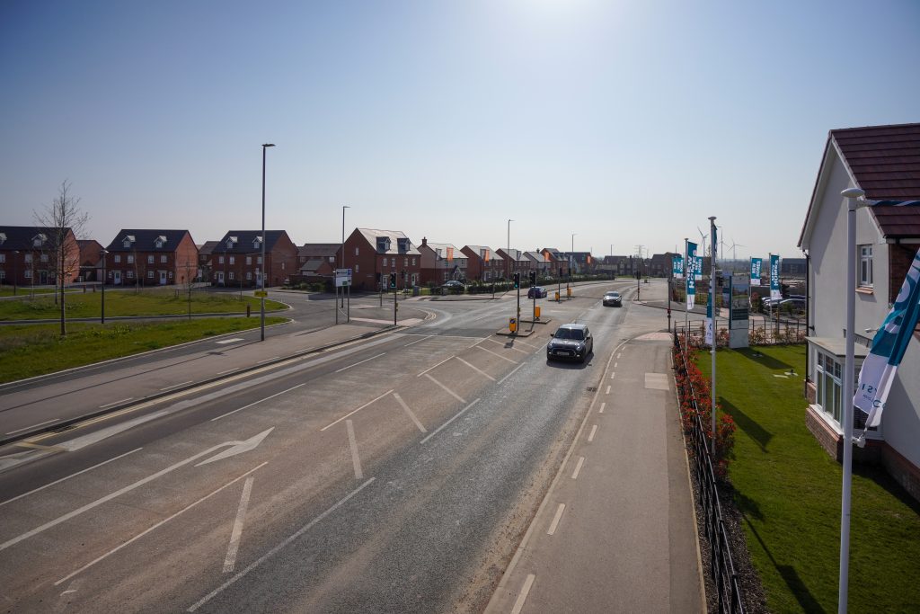
As part of the ongoing development of Middlebeck, a phased programme of road closures is due to take place at several locations along Bowbridge Road and Bowbridge Lane during November and December 2026.
We recognise that the road closures will have an impact on your day-to-day travel plans and, as such, we want to keep you as informed as possible about the works and their progress.
We also acknowledge that due to the complexity of the works, and scheduling difficulties resulting in changes to the program at very short notice, it was been difficult to provide accurate, timely information to residents to assist them in their journeys. We apologise for any inconvenience this has caused.
This page explains the full, new programme of works in the order of planned completion.
These dates are accurate at the time of publishing, however they may be subject to further change.
We will update this page throughout the works to keep you as informed as possible.
Please remember that the location of the road closures and the subsequent diversion routes may change as the works progress, so please do check the dates below before travelling.
Remaining programme of works
Phase 4
Planing, surfacing and white-lining works to footpaths.
- Mon 9/11 to Fri 13/11
- Sat 14/11
Full road closure from Gannets to the Middlebeck Way roundabout. Access to Middlebeck from school end only.
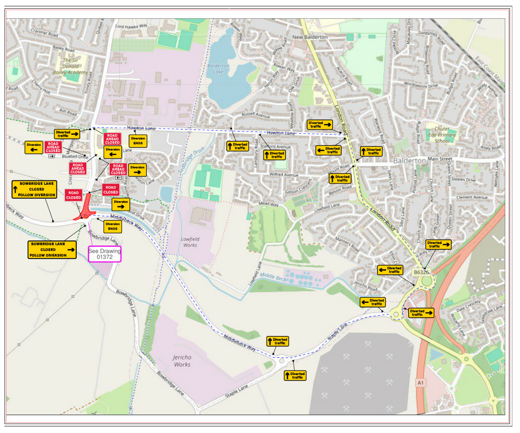
Phase 5
Lining, planning and patching works to footpaths and road.
- Mon 16/11 to Fri 20/11
- Sat 21/11
- Sun 22/11
Full road closure from Middlebeck Way roundabout to Bowbridge Lane towards cattery.
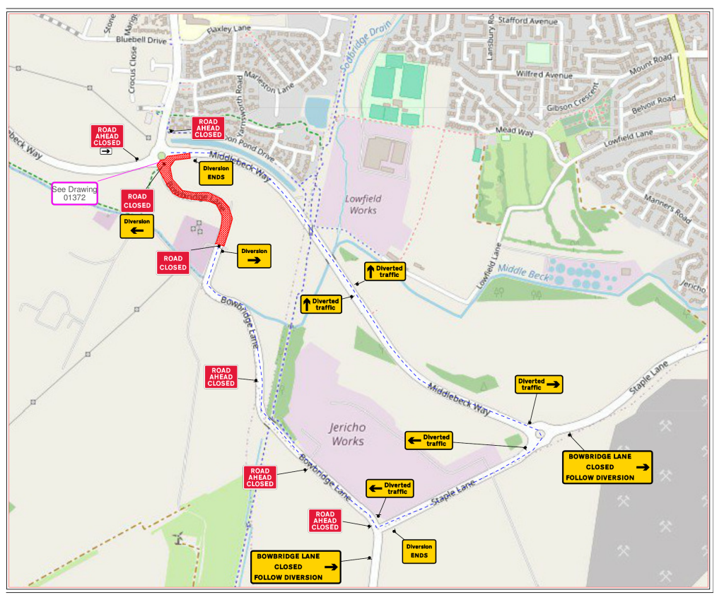
Phase 6
Verge levelling works
- Mon 23/11 to Weds 25/11
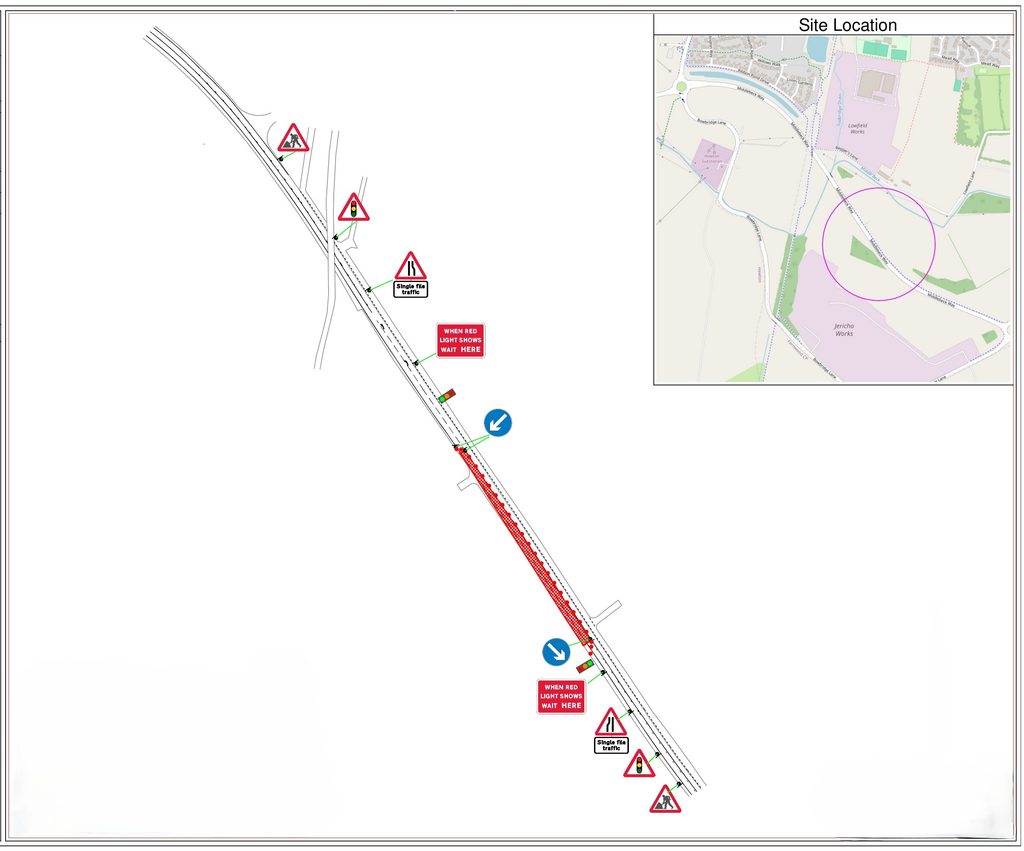
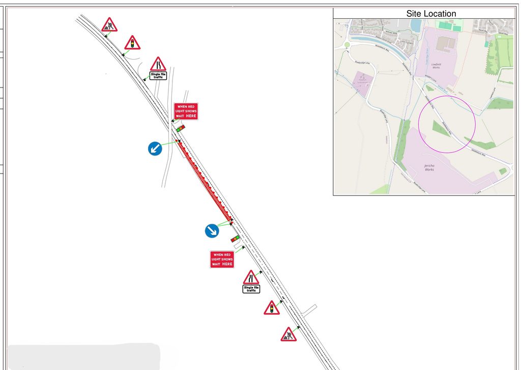
Middlebeck Way near to pedestrian bridge. Traffic management in place, traffic flow under temporary lights.
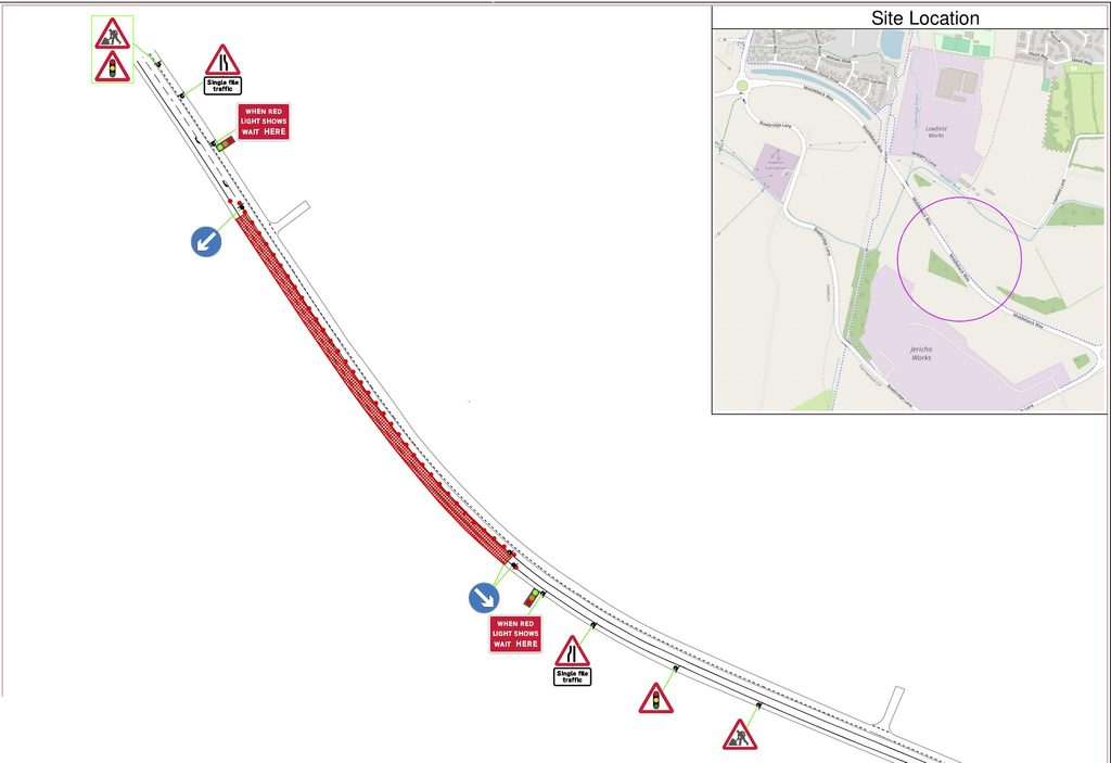
Phase 1A/1B
Lining, patching, and jetting works
- Sat 28/11 (1A)
- Sun 29/11 (1B)
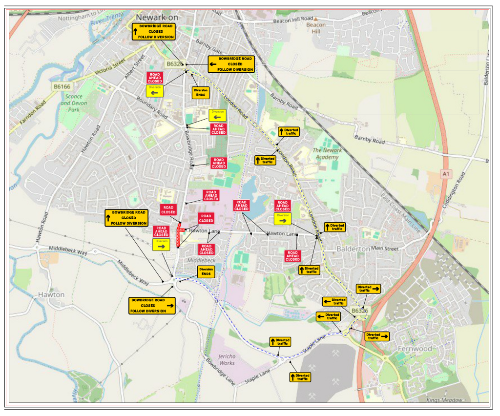
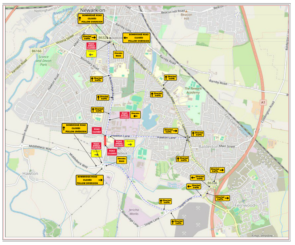
Full closure to Christ Church/Hawton Lane junction, as per diagram.
North of school (1A)
South of school (1B)
Phase 1B-2
Lining, patching, jetting works
- Sat 5/12
- Sun 6/12
Full closure to Christ Church School/Hawton Lane junction (south of school).
Road closures at a glance
Below is a quick-glance reference guide to the full programme of works:
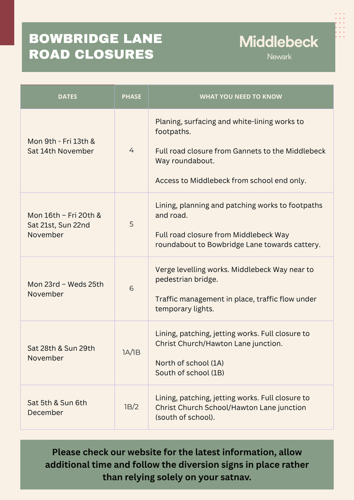
Click here to download a PDF copy of our Quick Glance road closure information sheet.
Understanding the maps
The following is a guide to help you fully understand the maps supplied.
We hope that this will help to simplify your decision-making when it comes to journey planning.
On each PDF version of the map:
- The red hatched area shows the location of the works
- The blue dashed line shows the signed diversion route
- The remaining symbols primarily show where the contractor’s temporary signs and barriers will be positioned
Before travelling
Please check this page for the latest information, allow additional time and follow the diversion signs rather than relying solely on your satnav.
We appreciate that the changing arrangements may cause some disruption and thank residents, businesses, schools and other road users for their patience while the works take place.
If you have any queries about the roadworks please send an email to newark@urbanandcivic.com